Risks and problems this service helps prevent
Working with incomplete subsurface information can lead to unexpected obstructions, damaged services, unstable ground, redesign, rework and unsafe excavation. Historical sites, filled ground and properties with limited records can contain buried features that are not shown on plans.
Unidentified voids, tanks, foundations, pipes or previous excavations can affect construction, drainage, piling, trenching and asset-maintenance decisions. Discovering these features only after machinery arrives can create expensive delays and force changes to the planned method of work.
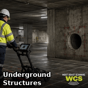
Subsurface scanning provides a non-destructive first look that can guide further investigation and help target physical verification. GPR results are interpretive and depend on ground conditions, moisture, depth, target size and material contrast, so professional assessment and clear explanation of limitations are essential.
What can be detected or assessed?
- Buried utilities and conduits where detectable
- Voids and disturbed or backfilled ground
- Buried slabs, footings and structural remnants
- Tanks, pits, chambers and possible foundations
- Changes in soil or pavement construction
- Other subsurface anomalies requiring further investigation
Typical projects and industries
- Civil and infrastructure planning
- Commercial and industrial redevelopment
- Mining and regional site investigations
- Excavation, trenching and drainage works
- Property development and renovation
- Engineering, environmental and facilities investigations
How the process works
- The project objective, available plans, access and likely target depth are reviewed.
- The scanning area is inspected and an appropriate survey grid or investigation path is established.
- GPR data is collected systematically across the accessible surface.
- Relevant anomalies and patterns are interpreted in the context of the site and any complementary locating information.
- Findings are marked or documented, and suitable next steps such as targeted verification are discussed.
What the customer receives
- Onsite markings of relevant detected features or anomalies
- A practical explanation of likely findings and limitations
- Approximate depths where the data supports a reasonable estimate
- Photographs, scan screenshots or marked-up plans where agreed
- A written subsurface investigation report where included in the scope
Why West Coast Scanning is well positioned to help
West Coast Scanning combines more than 12 years of hands-on scanning experience with direct personal service. Chris assesses the project, completes the fieldwork and explains the results, providing continuity from the first enquiry to the final findings instead of passing the job through layers of staff.
Our small family-business structure allows fast responses, flexible scheduling and competitive rates across Perth and regional WA. We use quality GSSI scanning technology and practical field methods, provide free quotes, and aim for same-day results and invoicing where the scope permits. Many clients return because they value clear communication and an operator who understands how the findings will be used onsite.
Frequently asked questions
What is the difference between subsurface scanning and utility locating?
Utility locating focuses on service routes such as cables and pipes. Subsurface scanning is broader and may investigate utilities, voids, structures, disturbed ground and other anomalies.
How deep can GPR scan?
Depth varies significantly with antenna frequency, soil type, moisture, conductivity, target size and material contrast. A practical depth range can be discussed after reviewing the site and objective.
Can GPR find every buried object?
No. GPR is a powerful investigation tool, but detection is not guaranteed. Conductive clay, wet or saline ground, deep targets and small objects can limit performance.
Will the ground need to be excavated?
The initial GPR survey is non-destructive. Targeted excavation or potholing may be recommended afterwards to physically verify important findings.
Can I receive a formal report?
Yes. Reporting can include photographs, scan findings, marked-up plans, relevant radar images and stated limitations, depending on the agreed scope.