Risks and problems subsurface scanning can help prevent
Incomplete plans, historic site changes and limited visible clues can leave important questions unanswered. Buried structures, unrecorded services, filled ground and voids may not be obvious until excavation or construction is already underway.
Working without reliable subsurface information can lead to damaged services, unexpected obstructions, redesign, rework, project delays and unsafe excavation conditions. On complex or older sites, discovering a buried slab, tank, footing or void after work begins can affect access, drainage, piling, trenching and the overall construction method.
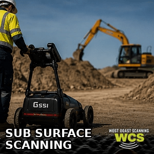
Subsurface GPR scanning helps reduce uncertainty by giving your team clearer information before work starts. It does not replace physical verification where that is required, but it can help target further investigation and support safer, more efficient planning.
What can be detected or assessed?
Depending on site conditions, access, ground type and the target itself, subsurface scanning may help investigate:
- Buried utilities, conduits and service routes where detectable
- Voids, disturbed ground and possible backfilled areas
- Buried slabs, footings, foundations and structural remnants
- Tanks, pits, chambers, ducts and other underground structures
- Changes in soil, pavement or ground construction
- Areas that may require targeted excavation, potholing or engineering review
- Approximate depths where the data supports a reasonable estimate
No single scanning method can identify every hidden feature on every site. Results depend on factors such as soil moisture, clay content, target size, material contrast, depth, access and surface condition. Clear limitations are part of a useful investigation.
Typical projects and industries
West Coast Scanning provides subsurface scanning for civil, commercial, industrial and infrastructure projects across Perth and regional WA. Typical work includes site investigations for redevelopment, excavation planning, trenching, drainage, roadworks, utilities, mining, facilities maintenance and property upgrades.
Our service is also useful when investigating older sites, areas with incomplete records, suspected voids, previous construction, buried obstructions or changes in ground conditions. Whether you are planning a new build, assessing an existing asset or preparing a work area for excavation, the aim is to provide practical information before the next stage begins.
How the subsurface scanning process works
- 1.Review the objective. Chris reviews the available plans, photographs, location, access requirements and the questions that need to be answered onsite.
nspect the work area. - The surface is assessed for access, likely target depth, safety requirements and any visible features that may assist the investigation.
- Collect GPR and locating data. The accessible area is scanned systematically using GPR and, where appropriate, complementary locating methods.
Interpret relevant findings. - Data is reviewed alongside site conditions, available plans and other locating information to identify relevant patterns, anomalies or detectable features.
- Explain the findings. Relevant features may be marked onsite or documented in photographs, screenshots, marked-up plans or a written report where included in the agreed scope.
What you receive
Your scope can be tailored to the project, but subsurface scanning may include:
- Onsite markings of relevant detected features or anomalies
- A practical explanation of likely findings and limitations
- Approximate depths where reliable data is available
- Site photographs, radar screenshots or marked-up plans where requested
- A verbal briefing for the project team
- A written subsurface investigation report where included in the quote
Why choose West Coast Scanning for subsurface GPR scanning?
West Coast Scanning is an owner-operated business with more than 12 years of practical scanning experience. You deal directly with Chris from the first enquiry through to the onsite work and findings. That means clearer communication, practical advice and fewer handovers between the person asking the question and the person completing the investigation.
We work with builders, civil contractors, engineers, electricians, plumbers, property managers and project teams throughout Perth and regional WA. Our approach is straightforward: understand the site objective, investigate the accessible area carefully, explain what the data indicates and be clear about any limitations.
Free quotes, flexible scheduling and same-day responses are often available where project conditions allow. Send through the site location, photos, plans and a short description of the work you are preparing for, and Chris can advise on the most suitable approach.
Frequently asked questions
What is the difference between subsurface scanning and utility locating?
Utility locating focuses on tracing services such as electrical cables, communications, water and gas lines. Subsurface scanning is broader. It may investigate utilities, voids, buried structures, disturbed ground and other anomalies that could affect excavation or construction planning.
Can subsurface scanning find every buried object?
No. GPR and other locating methods are valuable investigation tools, but detection is not guaranteed. Results can be affected by soil conditions, moisture, depth, target size, material type, reinforcement, surface access and other site-specific factors. Important findings may still require physical verification.
How deep can GPR scan?
Depth capability varies significantly between sites. Ground type, moisture, clay content, the antenna used and the target itself all affect the usable depth and clarity of the data. Chris can discuss what may be realistic after reviewing the site and project objective.
Can you scan for voids, tanks or old foundations?
Subsurface scanning may help identify patterns consistent with voids, tanks, buried slabs, footings, foundations or disturbed ground. The findings are interpreted in context and may be used to guide further investigation, targeted excavation or engineering review.
Do you work outside Perth?
Yes. West Coast Scanning provides subsurface GPR scanning throughout Perth and regional Western Australia. Share the site location, the area to be investigated and the required date so travel and scheduling can be included in the quote.